Political ecologist Eszter Kovacs and photo-journalist Toby Smith report on the water issues of Mussourie, Uttarakhand, India.
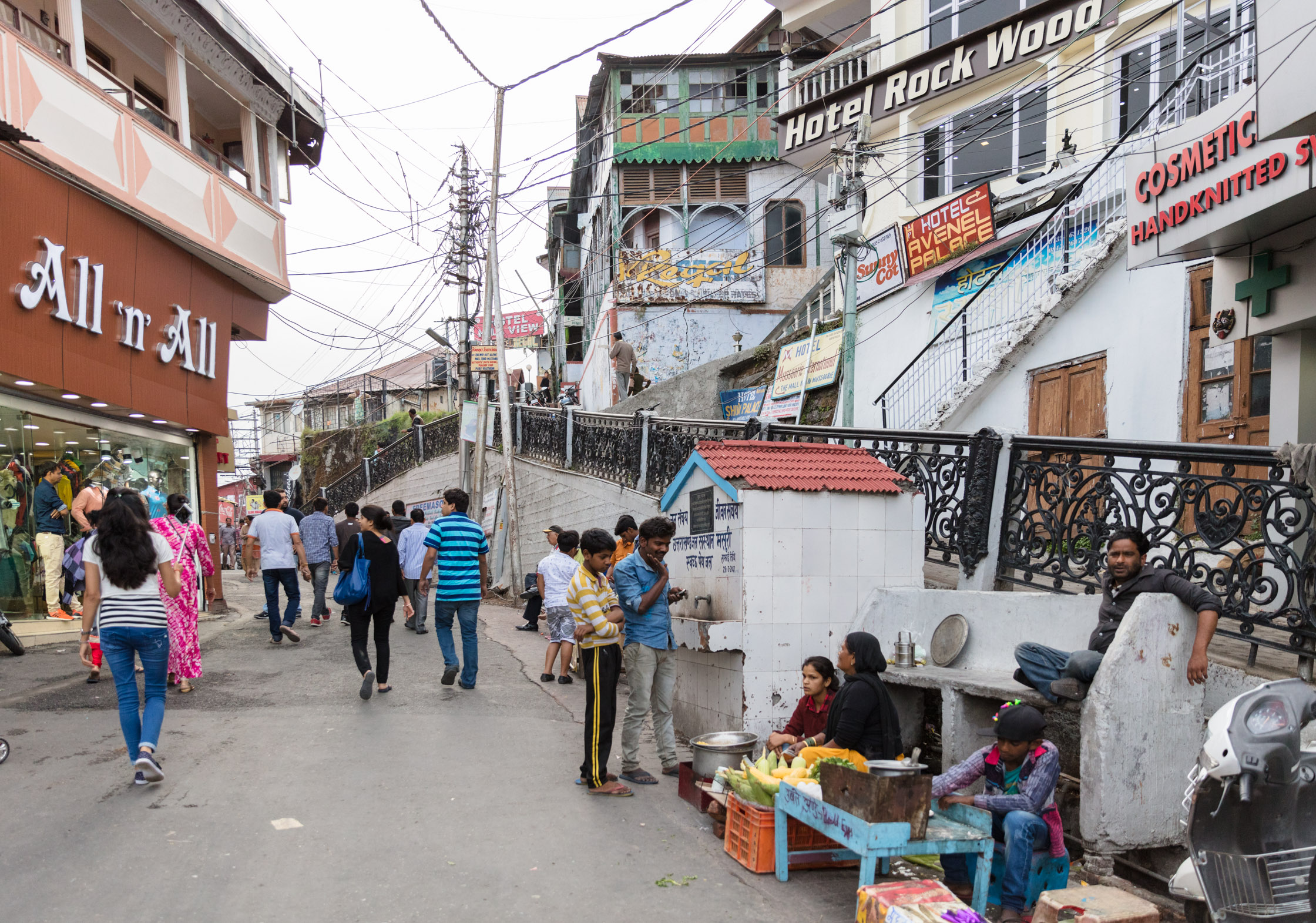
The hill station Mussoorie’s urban expansion is exhausting its spring-based drinking water supply. The town has been in a water crisis since early March, as the hot season’s scarcity meets its tourist peak.
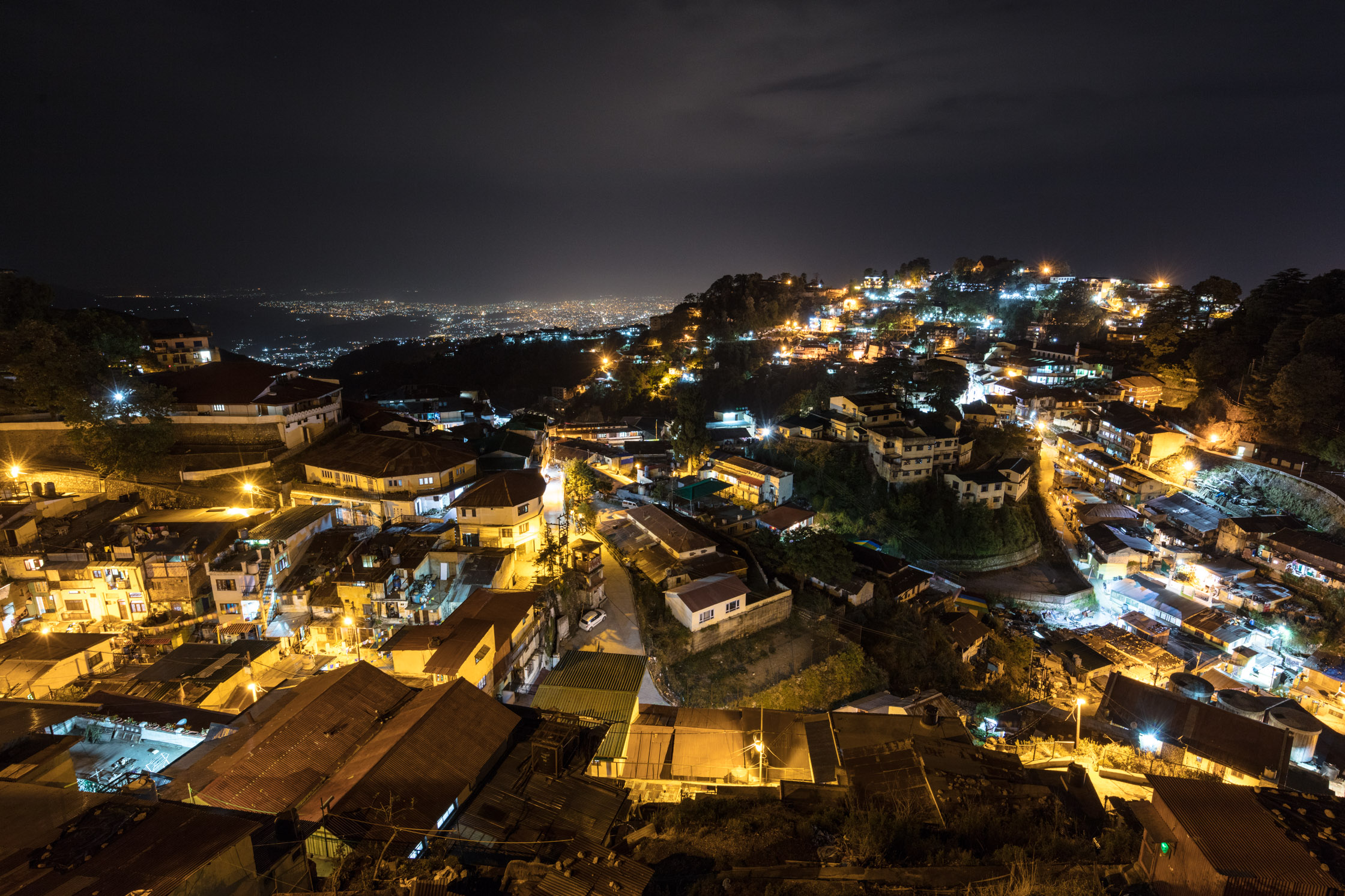
The tourist economy defines hill station towns across the lower Himalaya: visitors sustain and give rise to food vendors, hotels, local museums and amusement venues. In turn, they demand more and better roads, electricity, sanitation and water.
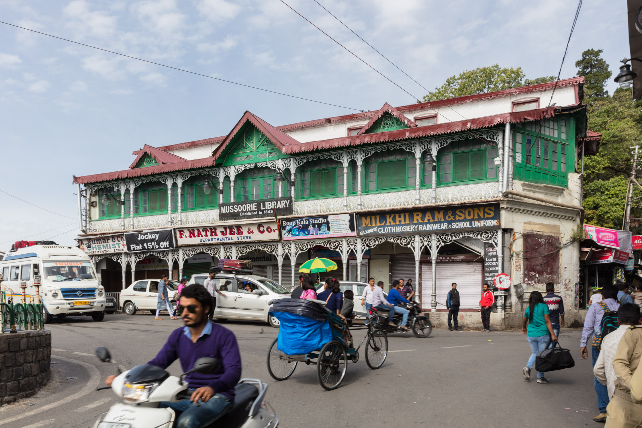
The numbers of tourists to Mussoorie have increased linearly over the past decade. According to local hoteliers and shopkeepers, people today are more likely to visit the town for short weekend breaks instead of week- long trips, leading to demand for services all through the year.
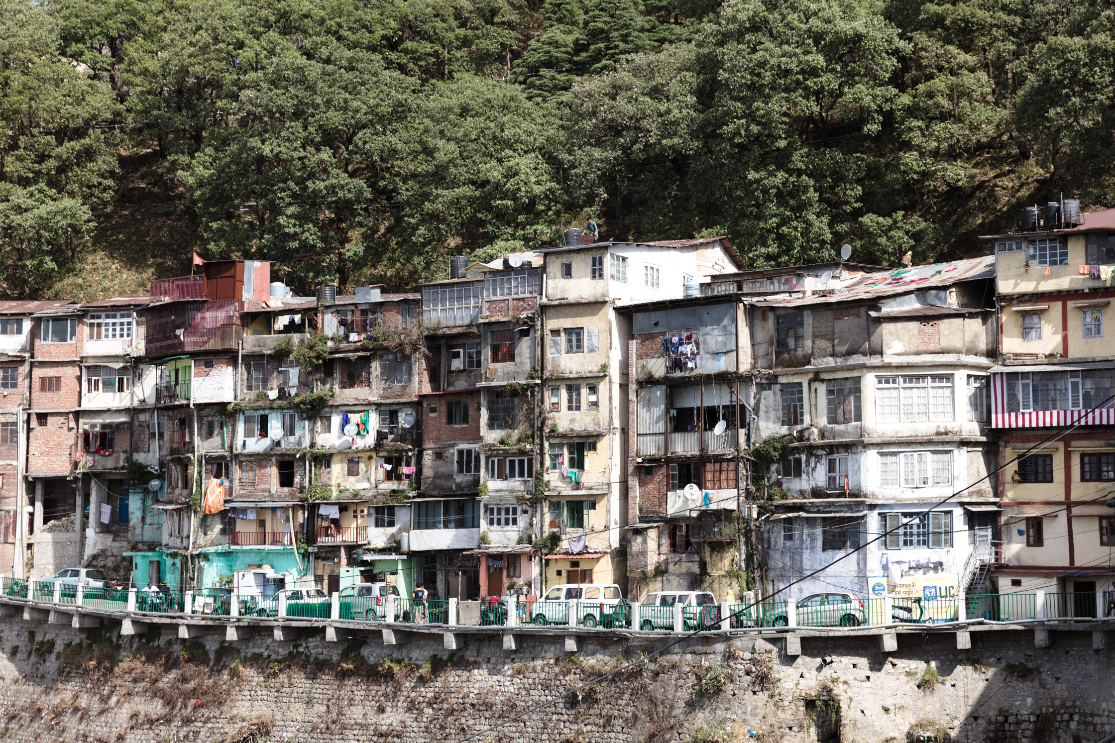
Mussoorie’s thirst for water is further propounded by the growing numbers of its permanent inhabitants, whose households tend to have informal status. However, these households successfully blur the lines between formality and informality vis-a-vis the state through their usually successful individualised access strategies for piped water.
From the time of hill stations’ Britisher establishment in the early- to mid- nineteenth century, the towns have been a respite from the scorching heat of the plains.
The roads linking the main Mall, Himalayan Club and Landour are the most popular walking, shopping and exhibit areas. This popularity has been matched as the majority sites of new hotel, vendor and houses’ construction.
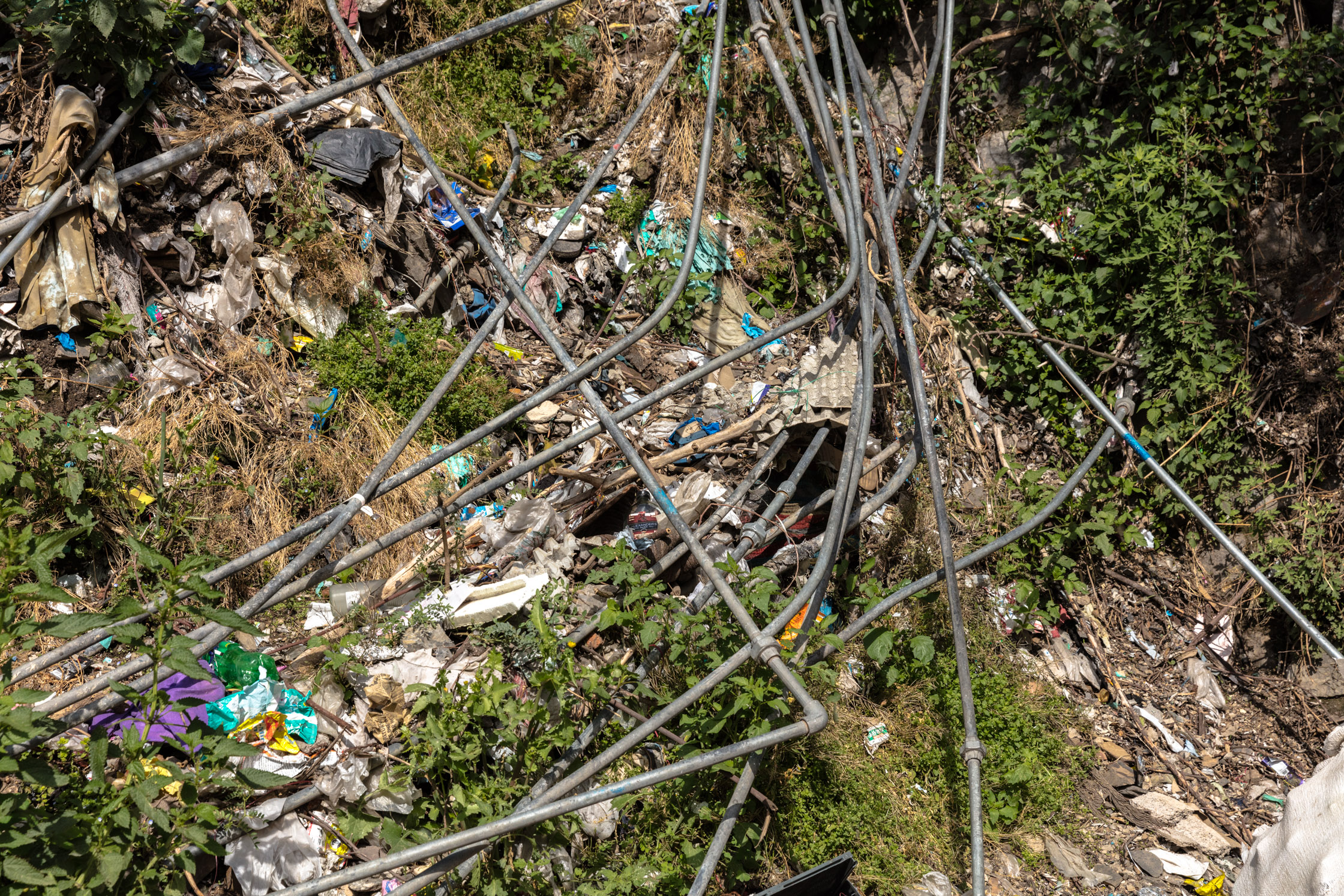
Linking all these landscape uses is the unchecked and lop-sided nature of urbanisation, which is overwhelmingly precarious and dangerously unplanned for a seismic zone that also experiences large seasonal rainfalls with attendant landslides.
Urbanisation has consisted of myriad tenuous tenements for new permanent arrivals as well as for the average tourist, but there has been little corresponding investment in sanitation, waste management, and water provision.
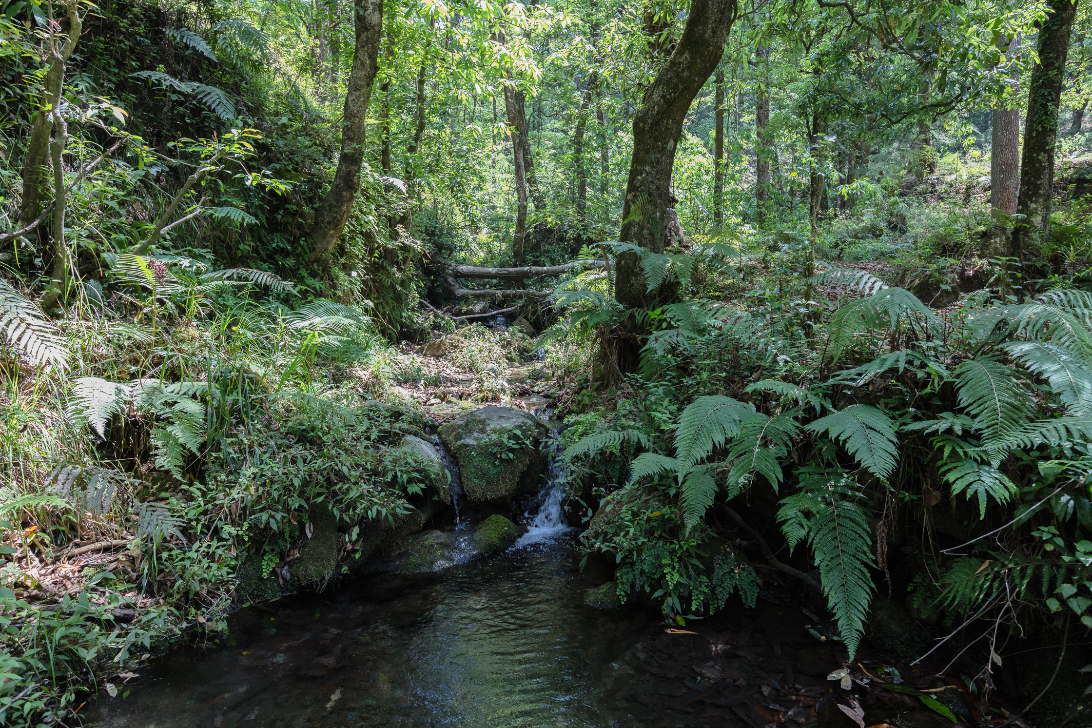
Water arrives to households in Mussoorie through a complex gravity- and pumping system that taps over twenty local springs. Over the past decades, these water sources have experienced serious declines, further stressed by the increased water demand of Mussoorie that now far exceeds its capacity.
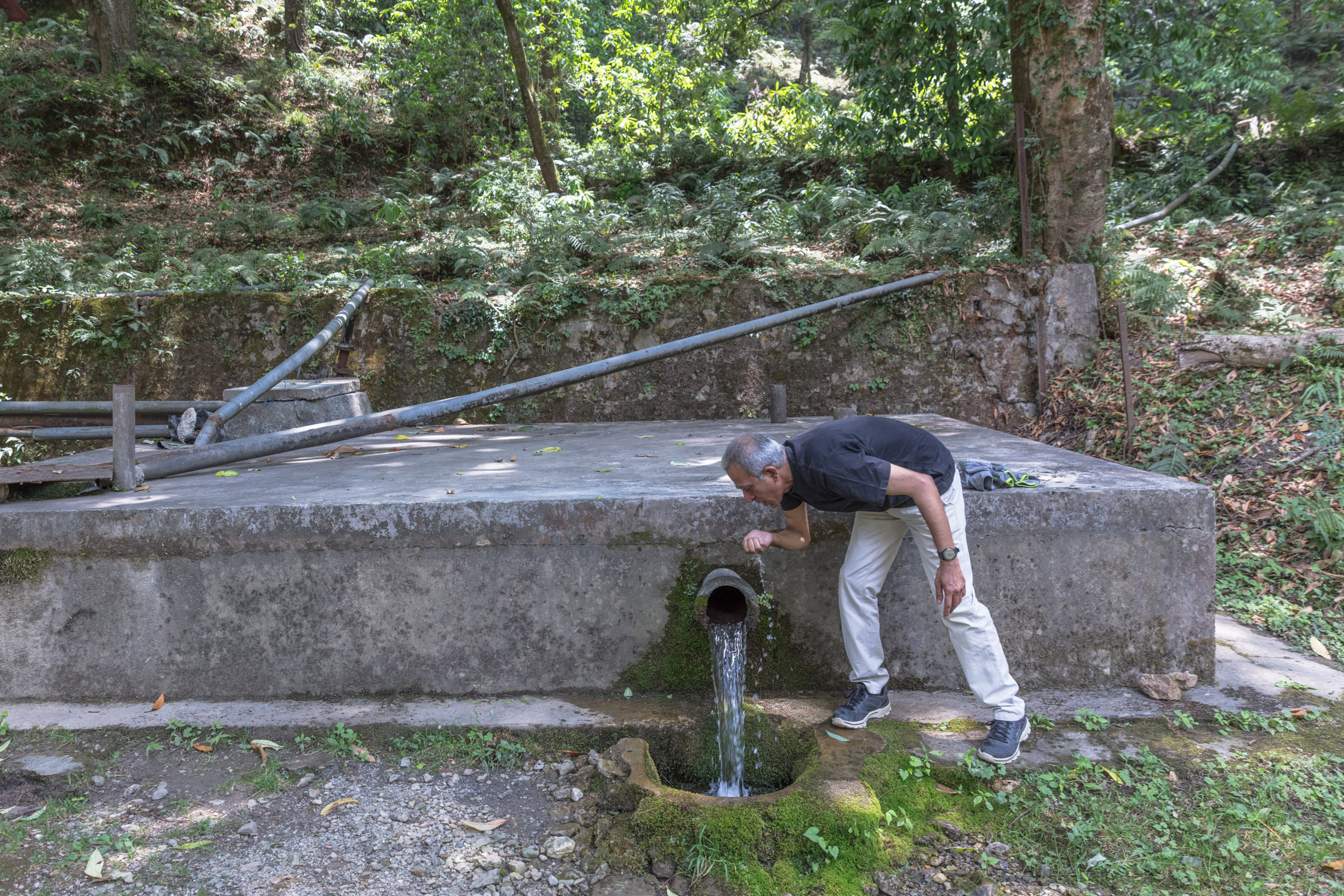
The continued development of Mussoorie as a town dependent on tourism seriously stretches and jeopardises the long-term sustainability of these springs, especially as water catchment areas are very visibly not adequately protected from construction nor tree felling, despite the Supreme Court ban from 1980.
Kempty Falls demonstrates how rapidly these processes take place, as the Falls have been built around through the past decade.
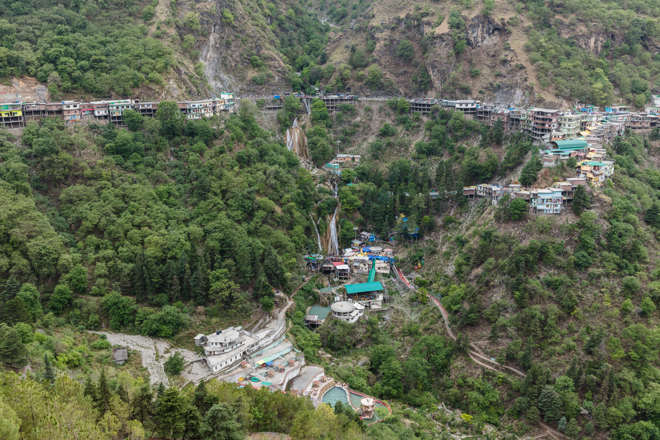
The construction surrounding the falls epitomises broader urbanisation processes that circumvent planning and safety for immediate expediency, access and profit, putting tourists at risk.
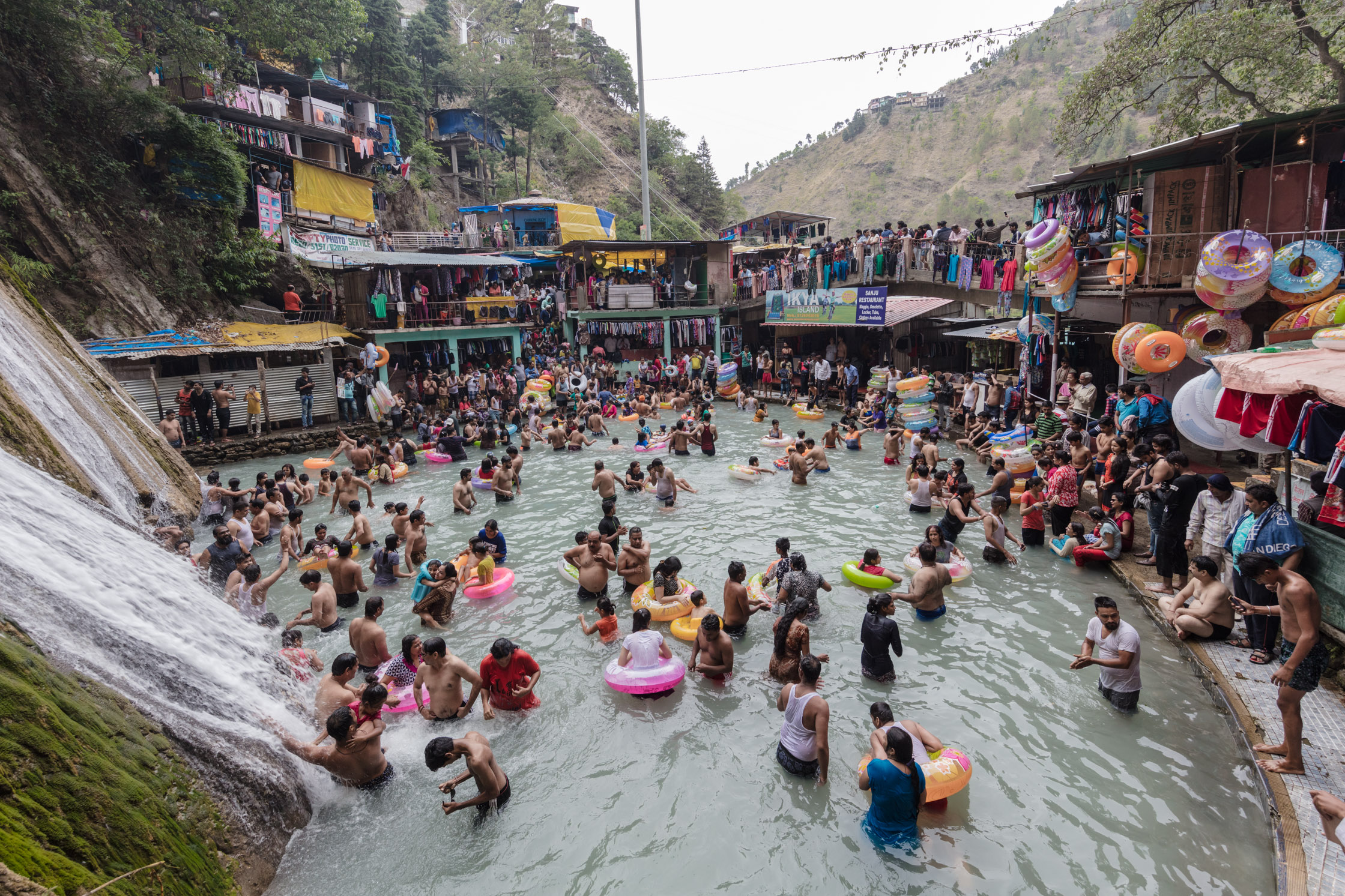
Further, the Falls depict how ‘tourism’ is no longer an activity only of the elite: local 50-rupee bus deals link surrounding villages and towns with the Falls, making the precarious facilities available to an ever-burgeoning crowd.
Changing tourist identity and demand also affects peri-urban and rural communities around Mussoorie, some of whom traditionally made their living from water, such as the local laundry-families at Dhobighat.
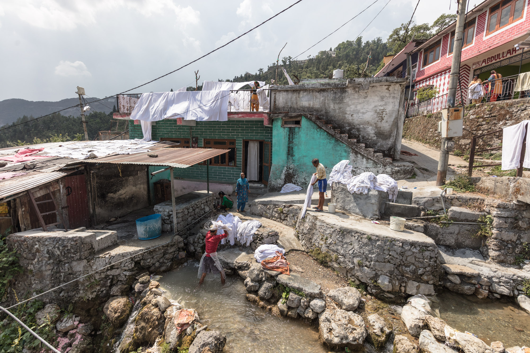
Demand for their services are in decline as their washing methods no longer meet tourists’ expectations: speed of laundry turn-around and higher cleanliness standards mean that both hotels and the Dhobighat community now invest in water- and energy- consuming washing machines and dryers.
These narratives and dynamics of growth, tourism, unregulated urbanisation, demand for services and water security concerns bind and challenge the hill stations of the lower Himalaya today, and call for a mountain-specific conversation and strategy around urbanisation and for the ecological maintenance of water systems.
Political ecologist Eszter Kovacs and photo-journalist Toby Smith report on the water issues of Naini-Tal, Uttarakhand, India.

Nainital is a bustling town in Uttarakhand, India, built around a pristine mountain lake. This lake or ‘tal’ provides the settlement with drinking water, scenic beauty and its economy as tourists flock to its shores every summer.
Yet for the second year in a row, the lake’s water levels have experienced drastic declines, exposing visitors to the polluted sight of the lake’s stony underbelly and the stench of decomposing carp and rubbish.

In response, a group of concerned residents and returning visitors have formed a Citizens of Nainital group to galvanise formal action urgently through petitions and to promote public understanding around the reasons for the tal’s severe water declines.

Falling lake water levels reveal the consequences of incremental urbanisation, of unchecked tourism and their combined water demand. While rainfall patterns and intensities are also slowly changing with climate change, the current water crisis is the result of myriad human-made factors.

Nainital’s population has grown by over 30% since 1991.
New homes and undeclared hostels that house and employ these people have built over historic drains that once directed water run-off into Naini’s lake, decreasing the amount of surface water flow entering the lake.

Other channels have been concretised, meaning that water seepage is no longer gradual or possible, effectively decreasing the amount of water entering the lake.
Tourist numbers have been steadily increasing over the past decade, such that water demand seasonally exceeds available supply.

The past few years have brought less rainfall and drought in the winter, as well as higher-intensity, shorter rains in the monsoon. Sudden water surges cannot be held by the lake and to prevent local flooding sluice gates allow the water to escape.
Significantly, a hydrology report from the 1990s established that one of the most important water recharge areas to Nainital is another seasonal upstream lake, Sukhatal. A faultline and complex aquifer system connects these two lakes, where water hostorically travelled and seeped slowly underground from Sukha to Naini.

This relationship has been broken, and the report ignored. Buildings have gradually encroached onto Sukhatal’s lakebed, beginning with the pumping station built by the Asian Development Bank, followed by a government parking lot, then private homes, permanent and makeshift. Construction waste is frequently stored on the lakebed, with frequent vehicle traffic and debris compacting Sukhatal’s bottom and giving rise to a swimming pool effect. This means that water no longer percolates or filters from the up- to the down- stream lake.

The tal’s crisis has been long predicted, as changes to Nainital’s condition have been gradual, not quick. In 1993, a Public Interest Litigation (PIL) was filed, urging rapid action to halt illegal construction and blockages to drainwater canals that feed the lake.

A new PIL was filed in 2014, explicitly drawing attention to the importance of Sukhatal as an important recharge area to Nainital lake. While the High Court has ordered the clearance of drains around Nainital, its actions on Sukhatal have been less forthcoming. In a recently published District Planning Report, the rejuvenation of Sukhatal was suggested through turning it into a permanent lake, in order to further its aesthetic appeal – to tourists.
Sealing the bottom of Sukhatal would prevent any subsurface water from reaching Nainital, in effect exacerbating the current downstream water crisis. The preferred solution displays an enormous misunderstanding of Sukhatal’s ecological role.

Just as Nainital gets its water from a myriad of sources, there will be no single solution to the lakes water levels. Actions need to be concerted, small and large: starting with drain clearance, existing building restrictions must be enforced and urban planning and development needs to be ecologically sensitive to where water recharge areas lie. The role and forms of tourism are rarely put under the spotlight, yet Nainital’s current trajectory compromises its long-term environmental sustainability, as well as the livelihoods of Nainital’s residents.

On the third of June 2017, the Citizens group will convene at the Mall on Nainital at 6pm for a silent, barefoot walk from Tallital to Mallital. Concerted, widespread action is only the beginning to “saving” the lake, and to ensuring that Nainital recovers its former beauty.
Political ecologist Eszter Kovacs and photo-journalist Toby Smith report on today’s local government elections in Dhulikhel, Nepal.
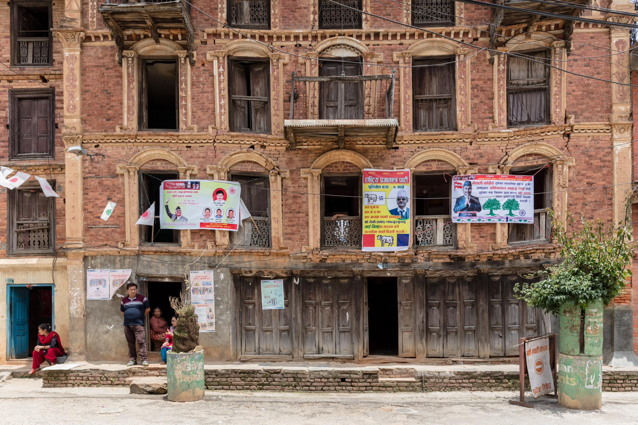
3 political parties are represented on one single dwelling in Dhulikhel Bazaar.
Nepal has not held local government elections for twenty years, and local democracy is claimed to be long overdue. Yet throughout this period contested and under-reported elections have been taking place within communities for the direct control and management of natural resources – particularly of water.
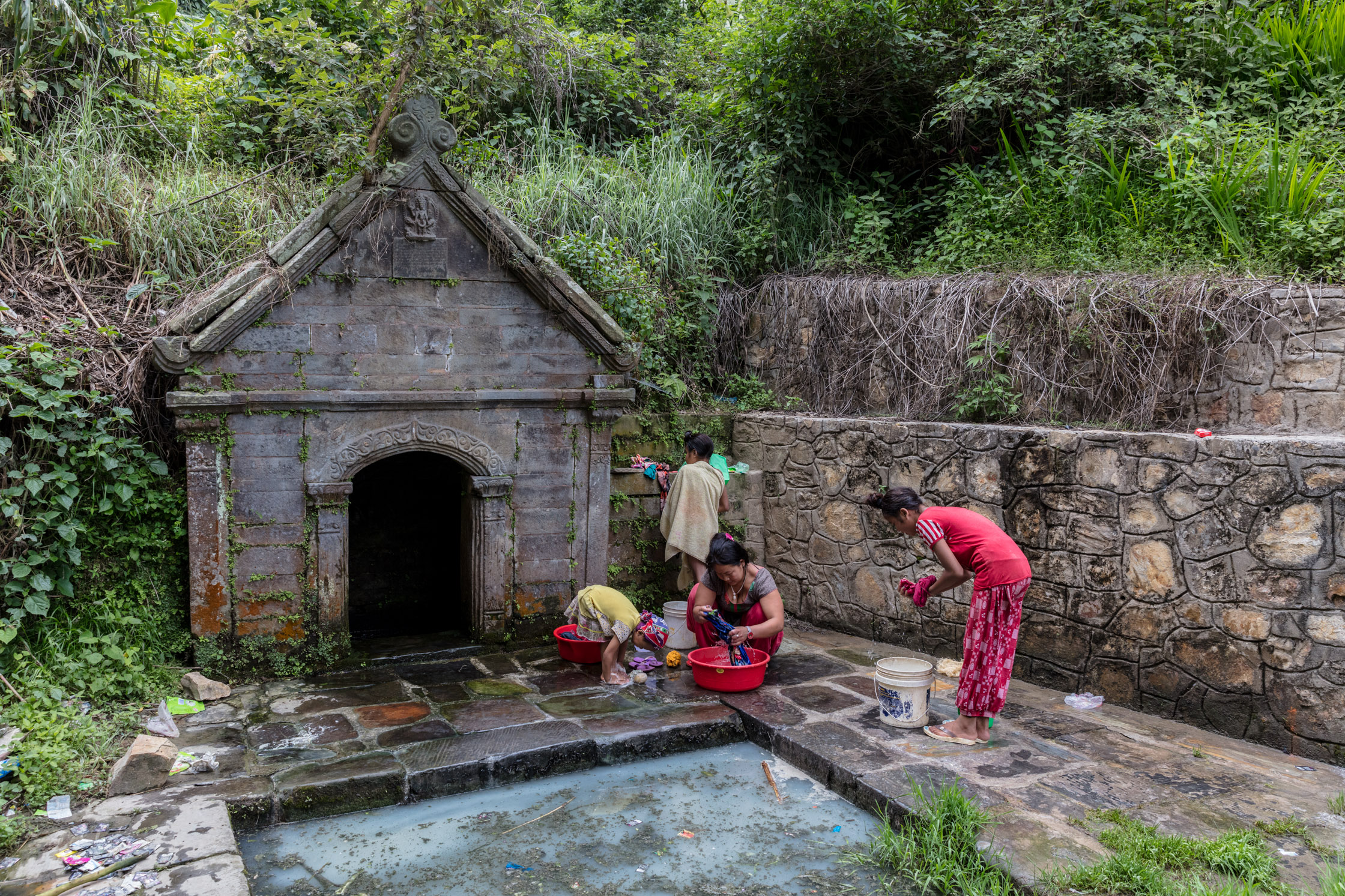
Communal spring in Dhulikhel.
In this same time, water’s importance as a resource across the Himalayas has grown. Local communities have had to overcome greater scarcity that has arisen through a combination of pressures from urbanisation, heightened demand and variable resource availability from a changing climate. The ability to control and improve people’s lives through better water supply has meant that water has also become a potent political resource.
Past water elections yielded many of the candidates that stood for Nepal’s first formal government elections since 1997. Candidates are in large number tried and tested leaders, well known to their voters as they cut their political teeth in drinking water management.
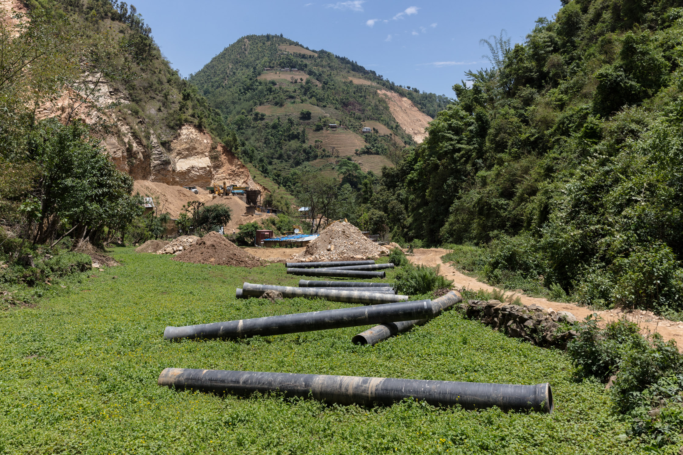
An ambitious infrastructure plan aims to divert water from the source of the River Roshi to Dhulikhel.
Ashok Byanju stood today as the likely Mayor-incumbent for Dhulikhel. Byanju heads the Steering Committee for the largest investment into Dhulikhel’s water supply system through the Kavre Valley Integrated Drinking Water Supply Project. His history with water is extensive, as Byanju was also a co-founder of the German-funded and nationally-lauded Dhulikhel Drinking Water Supply Project from the late 1980s. The promise and the exposure gained from these projects has led to Byanju becoming a well-recognised face, giving him a significant advantage over his six other mayoral hopefuls.
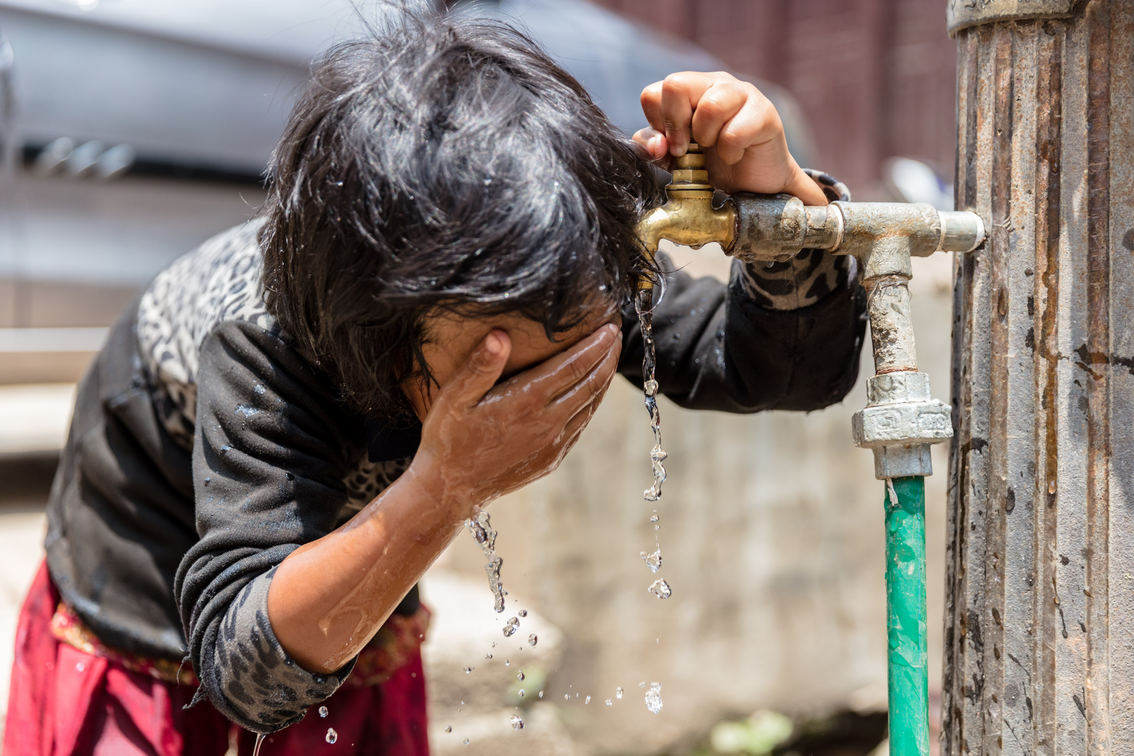
A young girl drinks from a potable water tap in Dhulikhel Bazaar.
The ability to improve the water lots of Dhulikhel’s population, which is rapidly increasing as the town experiences unprecedented urbanisation rates, has been evaluated through local elections for drinking water user committee members every three years since 1990. If leaders are unable to provide, they are booted out.
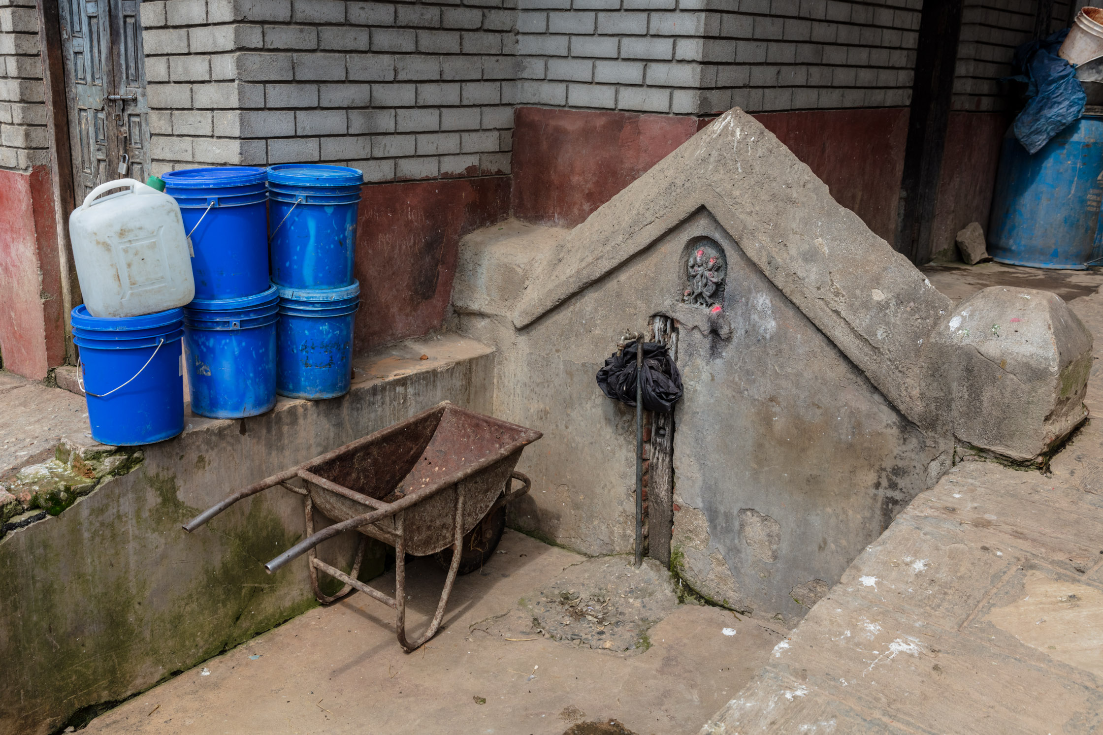
A tap fed by a sporadic spring runs dry.
The former committee President, Raj Kumar Shrestha Takhachhe, lost the campaign for his re-election in late 2016 by 69 votes. During the last eight months of his tenure, new households were prevented from obtaining a water connection over fears of water supply limits. Water supply has been unable to adequately keep up with the expansion of Dhulikhel’s borders. In consequence, the town’s supply system reinforces a core-periphery hierarchy, wherein peripheral, newer wards are not served.
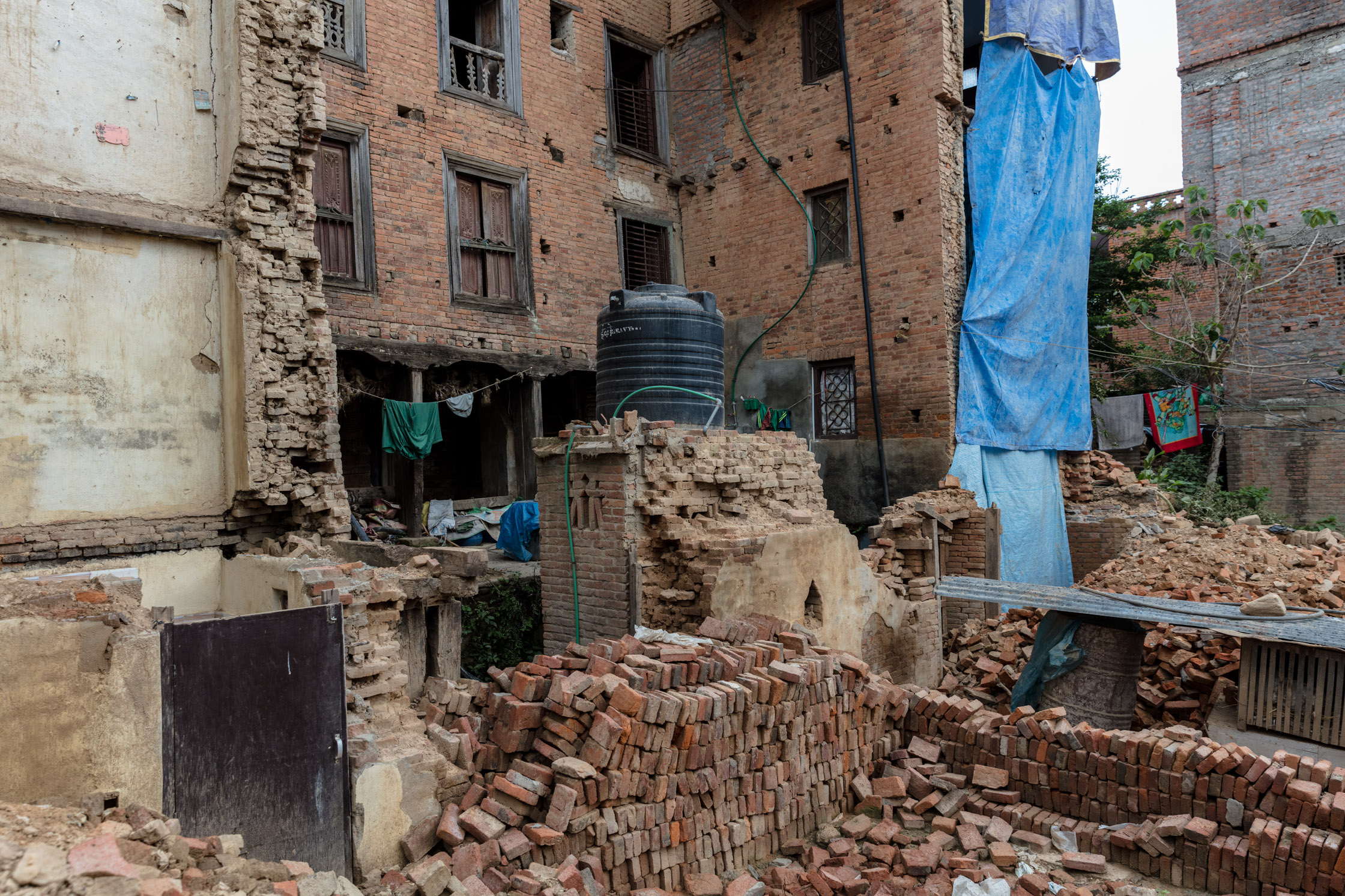
Many buildings in Dhulikhel lie in ruins following the 2015 earthquake.
The new alternate candidate for President of the drinking water committee, Rameshwor Shrestha Ghinanju, campaigned to provide water to everybody. Ward 7, a historically deprived area locally well-known for its political protests and water blockades, ensured in particular that Rameshwor would get a chance to make true his promise through voting en masse for the new candidate. And indeed: since becoming President, Rameshwor has made steady progress, initiating the drilling of a series of deep borewells during this past month.
These dynamics of electoral enthusiasm (with participation at around 75%) run counter to the general assumption that there has been place-based political stagnation and a lack of initiative for addressing local issues through democratic processes in modern Nepal.
Indeed, many water supply challenges have been met: over the years Dhulikhel has realised better coverage, water quality and supply hours. Current campaign promises include beautification projects that target several fetid, algal-bloom communal pools throughout the town, which gradually came into being as new construction blocked water seepage routes and prevented recharge.
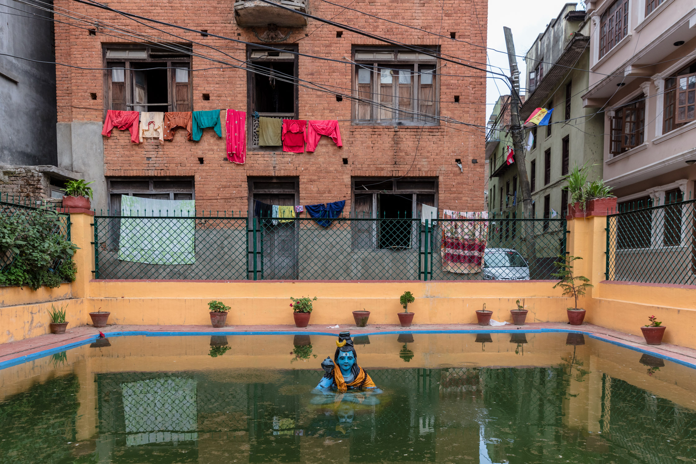
A public pond devoted to the Lord Shiva has turned stagnant.
At a larger scale and longer term, the impacts of climate change and a greater number of high-consumption stakeholders (including higher household water demands) threaten Dhulikhel’s development prospects. These issues are essentially universal across the Himalayas, as development pressures and populations meet finite and decreasing water availability.
“The tail of a dog never straightens even if you keep it in a tube for twelve years” – Nepali Proverb
Through history water has played a powerful role in determining where and how life is possible. The ability to control water supply and access in Dhulikhel in the early 1980s indelibly marked the town and set it on its current course. Dhulikhel’s last “official” mayor from two decades ago, Bel Prasad Shrestha, brought toilets indoors and donor money to “fix” and augment Dhulikhel’s water system.

Bel Prasad casts his vote at a town ward polling station.
Bel Prasad secured adequate water supplies such that Kathmandu University and later Dhulikhel’s hospital could be established. Bel Prasad identified the necessity and power of water, and the development it could bring. In recognition of the improvements his projects brought to everyday lives in Dhulikhel, Bel Prasad was asked to run for mayor in 1992, and was twice re-elected.
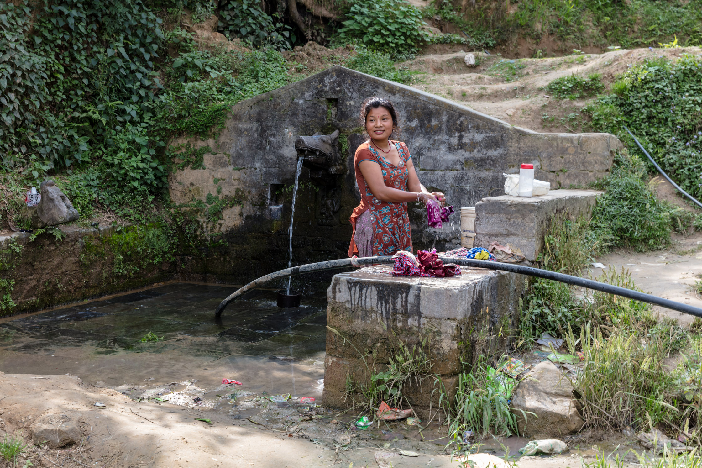
A young woman launders clothes in a communal spring.
This recent history of Dhulikhel’s water governance demonstrates how successful management hinges on the vision and commitment of particular individuals working within accountable, representative community groups. The effects of local government elections and the introduction of national-level political priorities on these already-existing community efforts are as yet unknown. Today, Dhulikhel’s young and old grasped the opportunity to have their voices and choices heard on a new stage, through known local leaders.
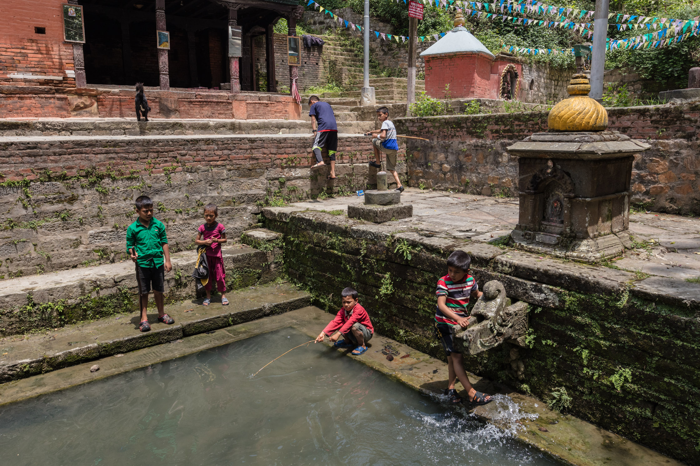
Nepali children play beside a temple pond.
Department of Geography, University of Cambridge
Collaboration with the Cambridge Coastal Research Unit
Exhibition Open to the Public
12th March 11am – 5pm
Filmed and Produced by Toby Smith
The Yorkshire Coast has long been synonymous and exemplary of coastal erosion and processes in Britain. The soft and fragile geology, stretching south from Bridlington to Spurn Head, contrasts sharply with the resilience of cliffs and formations at Flamborough Head. I was first introduced to this landscape during a GCSE Geography Field Trip and it has long been a personal metaphor for the fragility and temporary nature of landscape within a planet dominated by open-water.
Formation of the current Holderness landforms began during the last ice age some 50,000 years ago. As the advancing glaciers moved southwards they carried beneath them a vast quantity of material eroded from landmasses further north. Later as the ice sheets retreated this material was deposited burying the ancient coastline below a layer of boulder clay some 20 to 50 metres thick. By the end of the ice age, about 10,000 years ago, the coastline that we recognise today had been formed although it was some 15 to 20km east of its current position.
https://www.eastriding.gov.uk/coastalexplorer/pdf/1development.pdf
Almost immediately after this ancient deposition, the North Sea began to rapidly erode this clay coastline. Accelerated by the sinking of land-levels and the rising of sea-levels recent historic data suggests the coastline is lost at a rate of over 2m per year. The modern phenomenon of climate change, coupled with winter storm surges can see dramatic single events where land and property fall into the sea at an alarming rate. A favourite topic of national media especially when considering the changing policy and reduction in ‘investment’ in hard sea-defences.
Despite the claims of the Daily Mail, the loss of cliff-top settlements is not unique to recent history. Over 30 known villages have been lost on this coast since the Roman Era. Most eloquently discussed by Thomas Sheppard (F.G.S.) in his 1912 book ‘The Lost Towns of the Yorkshire Coast’.

This book and in particular the map insert, inspired me to produce a short-form video project to illustrate more poignantly the fragile nature of our coastline. I wanted to illustrate its transience and fragility not just over geological time-scales but within our more recent history.
I obtained a peer-reviewed map of the Yorkshire Coast that accurately plots the positions of 28 villages that are now situated between 200 and 1200m into the North Sea. By overlaying this map onto Google Earth it was possible to reveal the exact latitude and longitude of the villages. These coordinates were then used to charter a small fishing boat to their exact position at sea.
Filming West towards the coast, I selected a photographic lens equal in perspective to human vision and field of view. As an artist working on environmental issues I strive to make visual the often intangible reality of climate change. I will not claim here that the 13 villages depicted in this ‘work-in-progress’ piece are lost due to human activity. However, the expanse of forbidding water between their exact position and the distant coast-line I hope can inspire an understanding of how our activities can influence and accelerate damaging natural processes.
This year I was very pleased to be invited to contribute to 24 Photography. In 2004 they signalled the start of a photographic project that saw 24 postgraduate photography students, from Central Saint Martins College of Art and Design, document the first day of the New Year.
24 hours. 24 photographers. 24 images. 24 years.
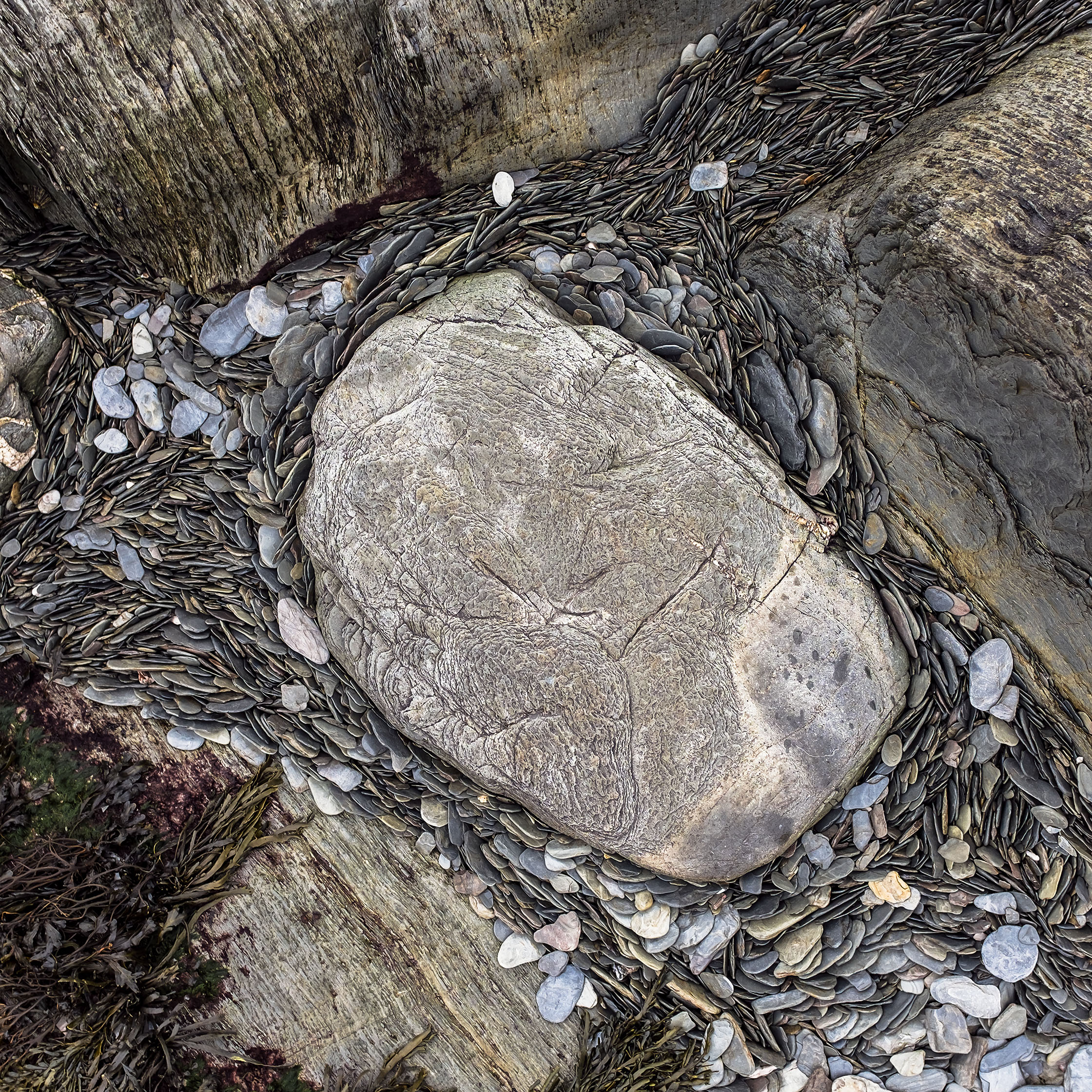
My frame was shot at 1400 on New Year’s Day, on Lee Beach in Devon.
Taken on Lee Beach in Devon, this area of outstanding natural beauty is famous for its unique, exposed geology and abundance of fossils. Tides and powerful wave action erode and shape the jagged coastline. At low water the tidal pools drain through the sediments chipped from the cliffs depositing shale into the cracks and crevices.
The current body of work can be seen in Soho Square on exhibition until Friday the 18th March with glowing reviews and features by both the BBC and The Independent.